![{[setting('site_name')]}](https://projxnews.com/uploads/setting/16983847711140531930.webp)
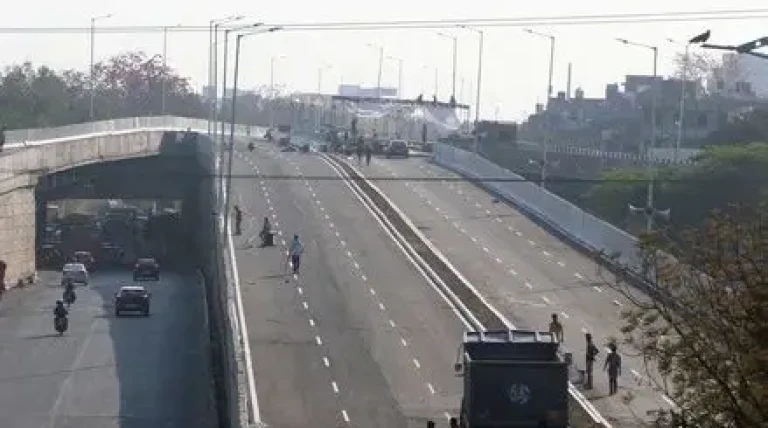

The Delhi government has moved forward on plans to ease congestion along one of the city’s busiest corridors, identifying a nearly 22-km stretch between Ashram and Mukarba Chowk as the most feasible starting point for Phase I of the proposed 57.5-km elevated Ring Road project.
According to PWD Minister Parvesh Verma, the detailed project report (DPR) prioritises this section due to its relatively obstruction-free alignment. Officials noted that fewer encroachments and simpler engineering requirements could allow quicker construction with minimal disruption compared to more densely developed stretches.
The project, referred to as the “Urban Ring Expressway,” will run above Mahatma Gandhi Marg (Inner Ring Road), forming a crucial elevated loop aimed at improving cross-city connectivity and reducing travel time.
The broader plan is divided into multiple phases, covering major junctions such as Majnu Ka Tila, Salimgarh Fort, Moti Bagh, Rajouri Garden, and Azadpur. The Ashram–Mukarba Chowk stretch itself will be implemented in three parts: Mukarba Chowk to Metcalf House, Majnu Ka Tila to Salimgarh Fort, and Salimgarh Fort to the DND Flyway.
Officials acknowledged that execution will require careful integration with existing infrastructure, including a grade separator and the Red Line near Kashmere Gate, to ensure seamless connectivity without disrupting current transport systems.
Heritage concerns are also significant, as the alignment passes close to protected sites like Salimgarh Fort, which falls under the Archaeological Survey of India. Authorities have said construction will strictly follow conservation guidelines.
The route also cuts through densely populated areas such as South Extension, Punjabi Bagh, Lajpat Nagar, and Ashram, raising concerns about traffic diversions during construction. The project’s cost is estimated between ₹5,500 crore and ₹8,000 crore, making financial planning another key factor.
Originally developed in the mid-20th century, the Inner Ring Road was intended to ease cross-city movement. However, rapid urban growth and rising vehicle numbers have turned it into one of Delhi’s most congested corridors.
What was once designed for a city of under three million people now serves a metropolitan population exceeding 30 million. Over time, key intersections such as AIIMS, Moolchand, Dhaula Kuan, Ashram and ITO have become major bottlenecks. While flyovers and underpasses have been added, officials note these solutions often shift congestion rather than resolve it—highlighting the need for a larger, integrated infrastructure upgrade like the elevated Ring Road.
News by Rahul Yelligetti.